Storm reports
October 13, 2026
View
Historical day
Range
Selected day
Event
All events
Sort
Most recent
Location
Any location
Search shortcuts
Enter a city, state, or ZIP in the area field to unlock direct shortcuts for the latest storm in that market and the full two-year archive view.
Matched
63
Hail
15
Wind
48
Tornado
0
15
Hail reports
October 13, 2026
63
Total storm reports
Hail · Wind · Tornado
2.75″
Largest hail
Reported hail size
5
Affected states
United States
48 / 0
Wind / tornado
48 wind · 0 tornado
Below the map
Detailed storm records and archive context
Use the sections below when you need exact line items, pagination, or matching historical storm days.
Matched reports
63
Hail reports
15
Wind reports
48
Tornado reports
0
Largest hail
2.75"
This month
231
Report table
October 13, 2026 storm activity
| Time | Event | Impact | Location | Notes |
|---|---|---|---|---|
| 11:03 PM | wind | Wind reported | Moberly, MO Randolph County | Downed tree and wires near Bertley Street. Time confirmed from radar. (EAX) |
| 10:55 PM | wind | 59 mph wind | 7 SE Hydro, OK Caddo County | (OUN) |
| 10:37 PM | wind | Wind reported | 4 S Kansas City, MO Jackson County | Downed wires near The Paseo. Time estimated from radar. (EAX) |
| 10:28 PM | wind | Wind reported | 3 WSW Salisbury, MO Chariton County | Reports of downed tree limbs and wires west of Salisbury. Time estimated from radar. (EAX) |
| 10:22 PM | wind | Wind reported | 7 WSW Raytown, MO Jackson County | Downed wires near 80th and Main. Time estimated from radar. (EAX) |
| 10:13 PM | wind | 63 mph wind | 2 SE Bonner Springs, KS Johnson County | Time corrected based on radar. (EAX) |
| 10:13 PM | wind | Wind reported | Brunswick, MO Chariton County | Several reports of tree limbs and wires down near Brunswick. Time estimated from radar. (EAX) |
| 10:00 PM | wind | 58 mph wind | 1 NE Rocky, OK Washita County | Personal Weather Station. (OUN) |
| 9:53 PM | wind | 59 mph wind | 4 SE Bogard, MO Carroll County | Private weather sensor. (EAX) |
| 9:50 PM | hail | 1.00" hail | 1 NW Odessa, TX Ector County | Hail ranging from pea to quarter size reported in central Odessa via social media. (MAF) |
| 9:48 PM | wind | Wind reported | 3 NNW Odessa, TX Ector County | Public report on social media of significant damage to a shed on the northwest side of Odessa. Other reports posted on social media showed limbs down near Sherwood and (MAF) |
| 9:38 PM | wind | Wind reported | 3 ESE Norborne, MO Carroll County | Downed tree limbs and wires near County Road 171. Time estimated from radar. (EAX) |
| 9:35 PM | wind | 59 mph wind | 4 NW Norborne, MO Carroll County | Private weather sensor. (EAX) |
| 9:08 PM | wind | Wind reported | 4 NNW Richmond, MO Ray County | Several reports of downed trees and wires near and north of Richmond. Social media photos of trees onto homes and vehicles in the Richmond area as well. Time confirmed (EAX) |
| 9:06 PM | wind | Wind reported | 1 S Homestead, MO Ray County | Several reports of downed trees and wires on the Ray County side of Excelsior Springs. Time estimated from radar. (EAX) |
| 9:05 PM | wind | 63 mph wind | 1 SE Orrick, MO Ray County | Private weather sensor. (EAX) |
| 9:04 PM | wind | Wind reported | 1 S Buckner, MO Jackson County | Social media report of tree limbs down near Buckner. TIme estimated from radar. (EAX) |
| 9:00 PM | wind | 60 mph wind | Lawson, MO Ray County | Time estimated from radar. (EAX) |
| 8:58 PM | wind | 72 mph wind | 3 SSW Mosby, MO Clay County | Private weather sensor. (EAX) |
| 8:56 PM | wind | Wind reported | 3 W Goodlett, TX Hardeman County | Overturned semi on US 287. (OUN) |
| 8:56 PM | wind | Wind reported | Excelsior Springs, MO Clay County | Trees and limbs down throughout Excelsior Springs. Time estimated from radar. (EAX) |
| 8:55 PM | wind | Wind reported | Norwich, KS Kingman County | Delayed report. Roof partially blown off of a shed and house. Power poles snapped within the area as well. Time estimated by doppler radar. Report relayed via county di (ICT) |
| 8:48 PM | wind | 88 mph wind | 3 W Goodlett, TX Hardeman County | (OUN) |
| 8:40 PM | wind | Wind reported | 1 S Liberty, MO Clay County | Social media report. Multiple trees down in Liberty. Time estimated from radar. (EAX) |
| 8:39 PM | wind | 61 mph wind | 11 S Kirkland, TX Cottle County | (LUB) |
| 8:36 PM | wind | Wind reported | 3 ESE North Kansas City, MO Jackson County | Downed wires near Lawndale Avenue. Time estimated from radar. (EAX) |
| 8:27 PM | wind | Wind reported | Platte Woods, MO Platte County | Trees and power lines down near 72nd and Prairie View. Time estimated from radar. (EAX) |
| 8:25 PM | wind | Wind reported | 1 SSE Northmoor, MO Clay County | Social media reports of tree limbs down in the Briarcliff area. Time estimated from radar. (EAX) |
| 8:22 PM | wind | 75 mph wind | 3 E Waldron, MO Platte County | Private weather sensor. (EAX) |
| 8:20 PM | wind | Wind reported | 2 N Maywood, KS Wyandotte County | Downed tree and wires near Hurrelbrink Road. Time estimated from radar. (EAX) |
| 8:18 PM | wind | Wind reported | Merriam, KS Johnson County | Tree limbs and wires down near Merriam Dr. Time estimated from radar. (EAX) |
| 8:13 PM | wind | 68 mph wind | Camden Point, MO Platte County | Time estimated from radar. (EAX) |
| 8:12 PM | wind | Wind reported | 2 N Waldron, MO Platte County | Downed wires near Jones-Myer Road. Time confirmed from radar. (EAX) |
| 8:02 PM | wind | Wind reported | 1 W Linwood, KS Leavenworth County | Large tree down near Route 32 and 206th Street. Time confirmed from radar. (EAX) |
| 7:53 PM | wind | Wind reported | 2 S Lansing, KS Leavenworth County | Large tree downed south of Lansing. Time estimated from radar. (EAX) |
| 7:45 PM | hail | 1.50" hail | Tonganoxie, KS Leavenworth County | Vehicle had dents and a cracked windshield. Strong winds also reported at the time. Time estimated from radar. (EAX) |
| 7:44 PM | wind | 60 mph wind | 3 NE Tonganoxie, KS Leavenworth County | Time confirmed from radar. Report relayed by emergency manager. (EAX) |
| 7:34 PM | hail | 1.00" hail | Turkey, TX Hall County | (LUB) |
| 7:30 PM | wind | 60 mph wind | 3 WNW Lawrence, KS Douglas County | (TOP) |
| 7:30 PM | wind | 70 mph wind | 6 SSW Easton, KS Leavenworth County | Report passed along for estimated 65-70 mph wind gusts. Time estimated from radar. (EAX) |
| 7:27 PM | wind | 81 mph wind | 2 WSW Turkey, TX Hall County | Measured by the TTU mesonet. (LUB) |
| 7:20 PM | wind | 58 mph wind | 2 W Wheeler, TX Wheeler County | Measured by Xcel mesonet 2W of Wheeler. (AMA) |
| 7:17 PM | wind | 60 mph wind | 5 SW Attica, KS Harper County | (ICT) |
| 7:13 PM | wind | 75 mph wind | 2 E Flomot, TX Motley County | Measured by the TTU mesonet. (LUB) |
| 7:10 PM | wind | 61 mph wind | 1 W Buffalo, OK Harper County | (OUN) |
| 7:10 PM | wind | Wind reported | Hazelton, KS Barber County | NWS employee reported 6 inch diameter live tree limbs down. (DDC) |
| 7:07 PM | wind | 59 mph wind | 3 ENE Topeka, KS Shawnee County | (TOP) |
| 7:02 PM | hail | 1.55" hail | 5 NE Tangier, OK Woodward County | (OUN) |
| 6:55 PM | wind | 59 mph wind | 6 NW White River Lake, TX Crosby County | Measured by the TTU mesonet. (LUB) |
| 6:53 PM | wind | 70 mph wind | 1 NW Grantville, KS Jefferson County | power pole reported down. (TOP) |
Page 1 of 2 | 63 matched reports
SPC convective outlook
Where severe weather is expected — October 13, 2026
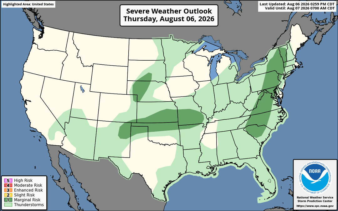
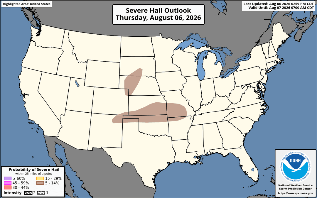
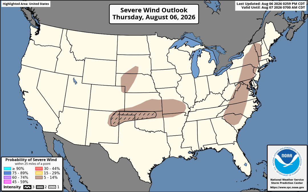
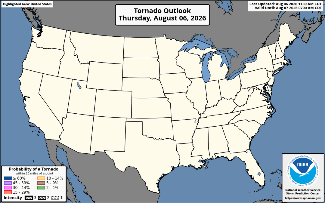
Source: NOAA Storm Prediction Center. Outlook imagery updates on the SPC schedule throughout the day.
Need a hail report for a specific address?
Get a detailed hail history for a property, job site, roof claim, or insurance file — built from verified storm data.