Storm reports
October 10, 2026
View
Historical day
Range
Selected day
Event
All events
Sort
Most recent
Location
Any location
Search shortcuts
Enter a city, state, or ZIP in the area field to unlock direct shortcuts for the latest storm in that market and the full two-year archive view.
Matched
23
Hail
0
Wind
13
Tornado
10
0
Hail reports
October 10, 2026
23
Total storm reports
Hail · Wind · Tornado
0″
Largest hail
No hail reported
6
Affected states
United States
13 / 10
Wind / tornado
13 wind · 10 tornado
Below the map
Detailed storm records and archive context
Use the sections below when you need exact line items, pagination, or matching historical storm days.
Matched reports
23
Hail reports
0
Wind reports
13
Tornado reports
10
Largest hail
N/A
This month
231
Report table
October 10, 2026 storm activity
| Time | Event | Impact | Location | Notes |
|---|---|---|---|---|
| 10:50 PM | wind | Wind reported | 3 WNW Oro Valley, AZ Pima County | Trees down on Moore Rd. (TWC) |
| 10:15 PM | wind | Wind reported | 8 SW Oro Valley, AZ Pima County | Tree down on two cars. Time estimated based on radar. (TWC) |
| 9:53 PM | wind | 58 mph wind | 6 SW Tucson, AZ Pima County | ASOS station KTUS Tucson International Airport. (TWC) |
| 6:12 PM | wind | 68 mph wind | 3 NW Arlington, WY Carbon County | Mesonet station WY22 2.7 NW Arlington (WYDOT). (CYS) |
| 5:58 PM | tornado | Tornado report | 5 NNE Aiken State Park, SC Aiken County | Aiken County EM relayed a report of two downed trees. One near the interaction of Coleman Bridge Road and Quail Run Road... the other near the intersection of Coleman B (CAE) |
| 5:46 PM | wind | 68 mph wind | 9 WNW Elk Mountain, WY Carbon County | Mesonet station WY17 8.9 S Hanna (WYDOT). (CYS) |
| 5:40 PM | wind | 63 mph wind | 5 NW Crestline, CA San Bernardino County | Mesonet station 711SE Silverwood West (SCE1711) reported a gust of 63 mph with a line of convection moving north ahead of Tropical Storm Rachel. (SGX) |
| 5:36 PM | wind | 70 mph wind | 15 E Sinclair, WY Carbon County | Mesonet station WY15 14.5 E Sinclair (WYDOT). (CYS) |
| 5:31 PM | wind | Wind reported | 2 NE Scottsbluff, NE Scotts Bluff County | 6 power poles were blown over on 42nd St resulting in a power outage to 176 customers. Time was estimated based on radar. (CYS) |
| 5:16 PM | wind | 59 mph wind | 4 SSE Beaumont, CA Riverside County | Highland Springs RAWS reported a wind gust of 59 with a line of convection moving north ahead of Tropical Storm Rachel. (SGX) |
| 5:15 PM | tornado | Tornado report | 5 SSW Elko, SC Barnwell County | Storm Spotters reported tornado northwest on Barnwell along 278. Radar confirmed debris as well. (CAE) |
| 5:10 PM | tornado | Tornado report | 3 NNW Barnwell, SC Barnwell County | Storm spotters showed video of tornado on the ground near highway 37. Radar confirmed debris as well. (CAE) |
| 4:47 PM | tornado | Tornado report | 1 WSW Kline, SC Barnwell County | Storm spotters showed video of tornado on the ground west of Kline. Radar confirmed debris as well. (CAE) |
| 4:47 PM | wind | 60 mph wind | 8 NE Temecula, CA Riverside County | Lake Skinner RAWS reported a peak wind gust of 60 mph with a band of convection moving north ahead of Tropical Storm Rachel. (SGX) |
| 4:40 PM | wind | 65 mph wind | 3 NNE San Jacinto, CA Riverside County | KWRP San Jacinto (SEA60) reported a peak wind gust of 65 mph with a band of convection moving north ahead of Tropical Storm Rachel. (SGX) |
| 4:37 PM | tornado | Tornado report | 3 N Appleton, SC Allendale County | 911 call center reported numerous trees and power lines down along Miller Creek Rd. Damage was likely due to a tornado. Time was estimated via radar data. (CHS) |
| 4:20 PM | wind | 66 mph wind | 4 NNE Murrieta, CA Riverside County | Elderberry St Mesonet (359SE) reported a 66 mph wind gust in a band of convection moving north ahead of Tropical Storm Rachel. (SGX) |
| 4:17 PM | tornado | Tornado report | 6 SSW Appleton, SC Allendale County | SCEMD reported four homes located along the 11000 block of Burtons Ferry Hwy with damage likely due to a tornado. They reported three of the homes with major damage and (CHS) |
| 4:15 PM | wind | Wind reported | 3 E Fallbrook, CA San Diego County | Spotter reported top half of 30 ft. Pine tree snapped off. The Fallbrook RAWS reported a 56 mph wind gust at this time with a band of convection moving north ahead of T (SGX) |
| 3:36 PM | tornado | Tornado report | 6 W Waynesboro, GA Burke County | Numerous reports with video and drone footage of several destroyed homes... flipped farm equipment... and considerable tree-powerline damage along highway 80 west of Wa (CAE) |
| 3:27 PM | tornado | Tornado report | 2 NW Newington, GA Screven County | Fire Chief reports trees down on mobile home. No injuries reported. (CHS) |
| 3:17 PM | tornado | Tornado report | 2 SSE Hunters, GA Screven County | A 911 call center reported roof damage possibly to multiple homes near Hilltop Lane at Savannah Hwy. A downed power pole was also reported. Damage was likely due to a t (CHS) |
| 2:33 PM | tornado | Tornado report | 5 WNW Oliver, GA Screven County | Picture of ongoing tornado near Effingham Highway. Spotter noted trees were being shredded by the tornado. (CHS) |
SPC convective outlook
Where severe weather is expected — October 10, 2026
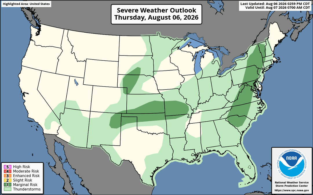
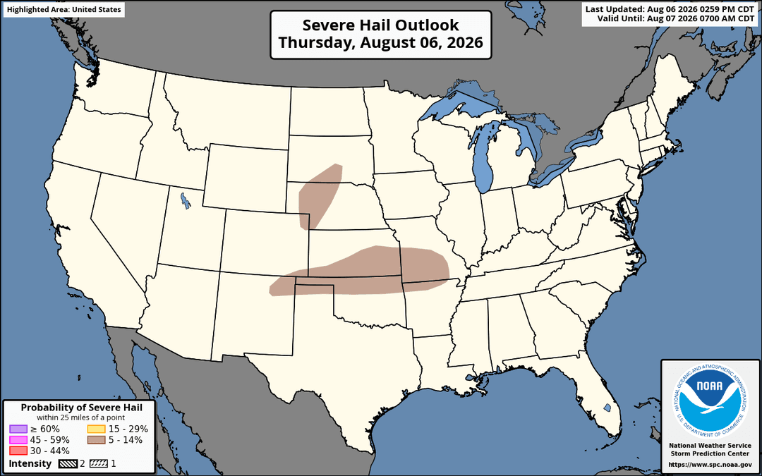
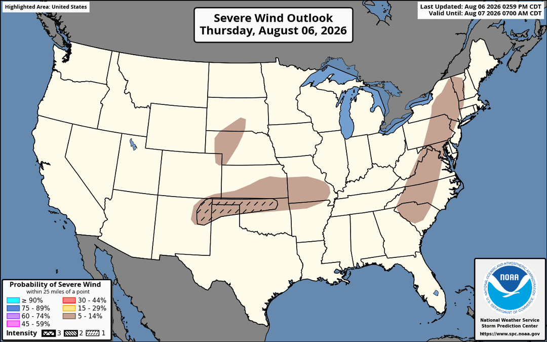
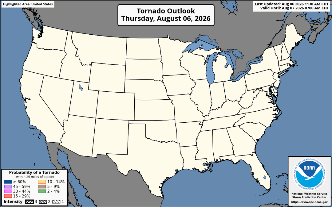
Source: NOAA Storm Prediction Center. Outlook imagery updates on the SPC schedule throughout the day.
Need a hail report for a specific address?
Get a detailed hail history for a property, job site, roof claim, or insurance file — built from verified storm data.